UAV Dynamics and Control
JSBSim-based and in-house flight dynamics models for fixed-wing and multi-rotor vehicles, with manual and SCAS-assisted control loops.
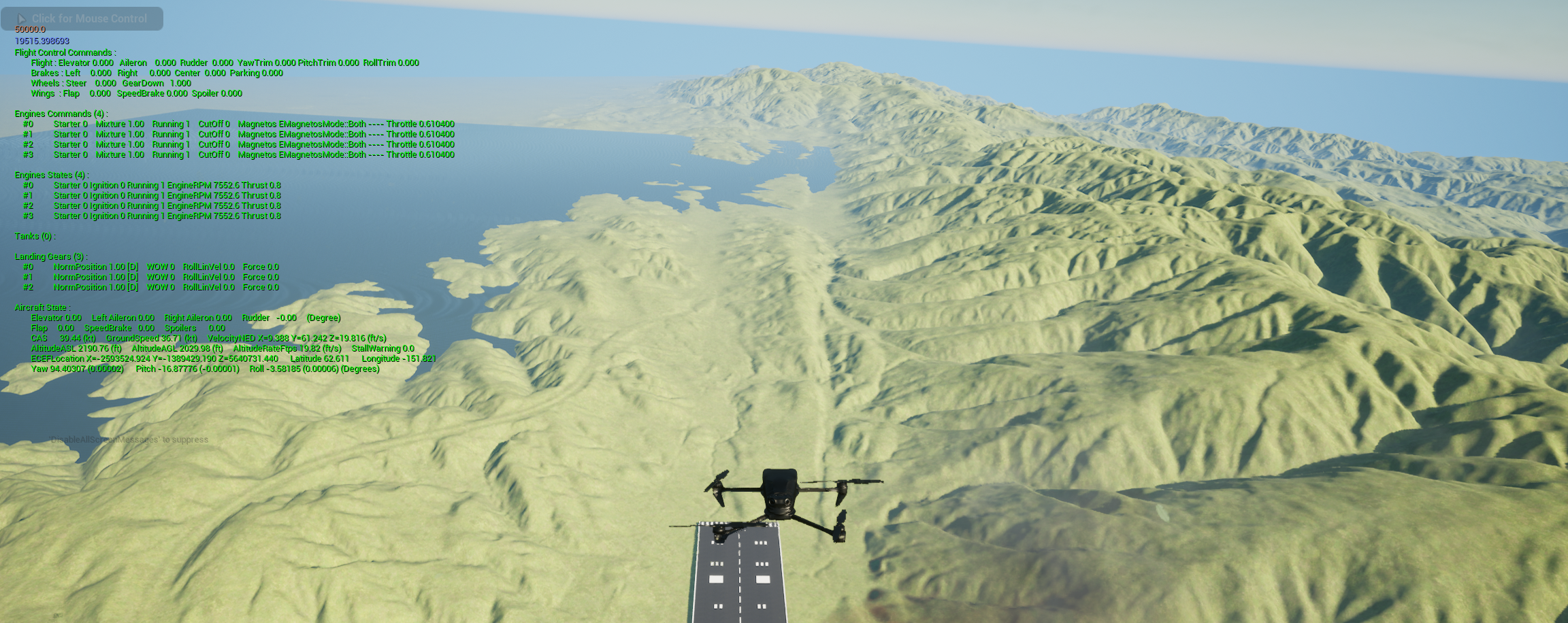
JSBSim-based and in-house flight dynamics models for fixed-wing and multi-rotor vehicles, with manual and SCAS-assisted control loops.
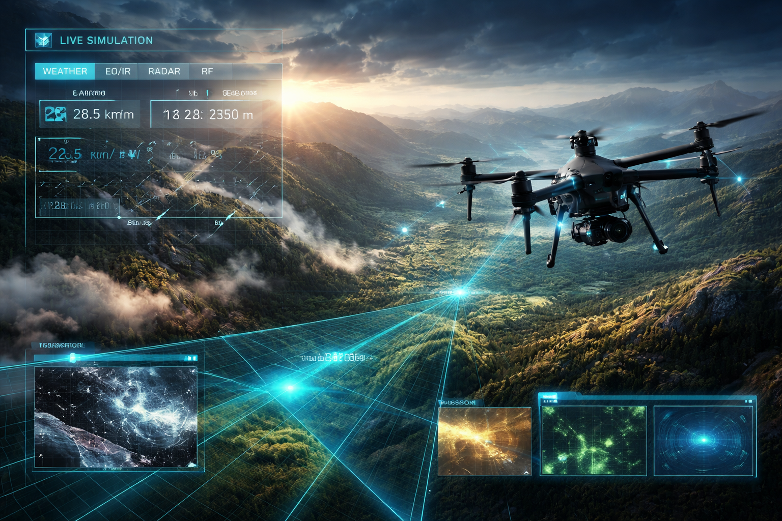
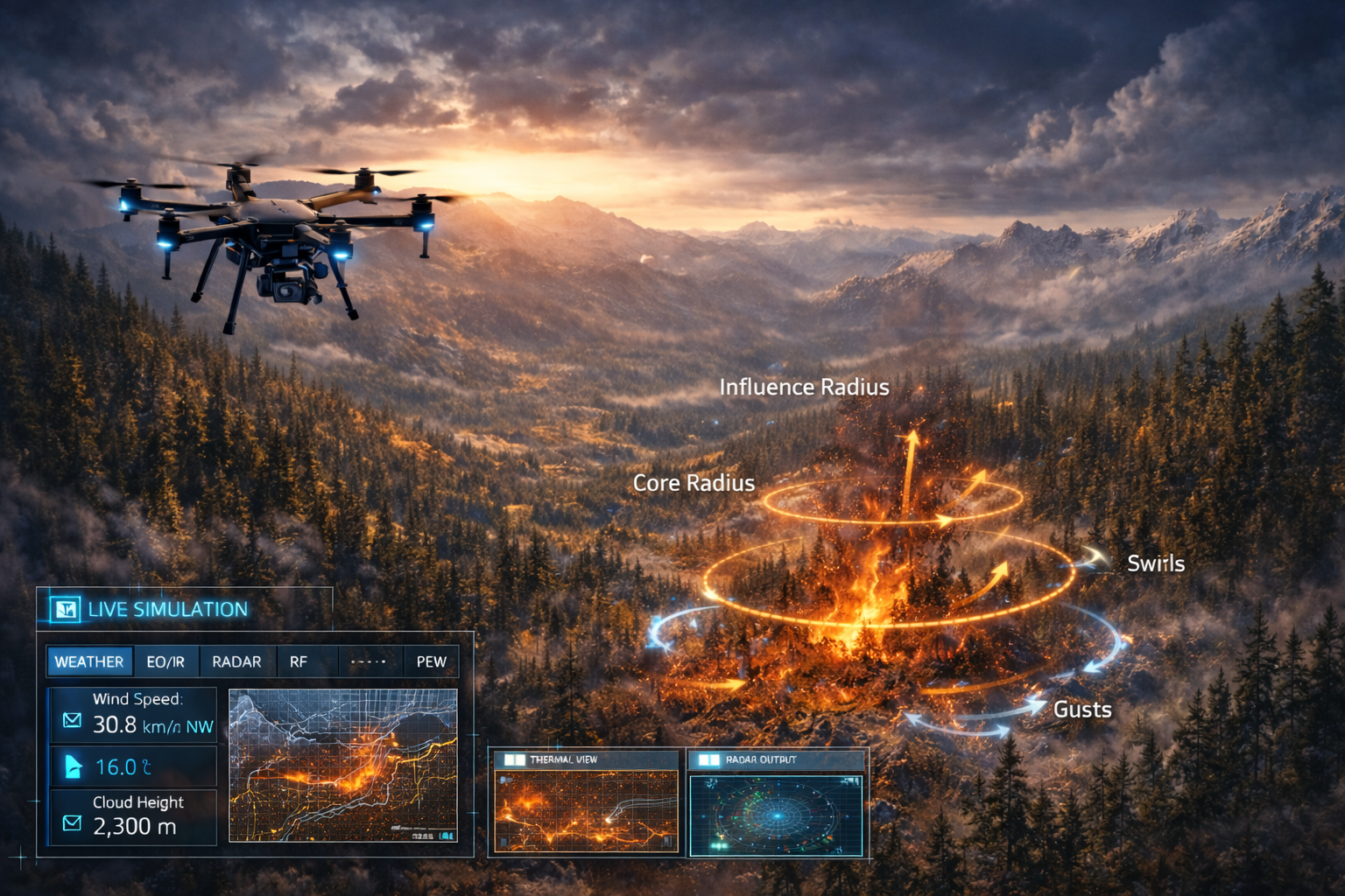
Scenario generation with real weather fields, wind shear, gusts, and wildfire disturbance overlays for pilot training and algorithm stress tests.
Closed-loop interfaces for real UAV controllers and mission systems, enabling software-in-the-loop and hardware-in-the-loop validation.
Real map and wildfire data are used to test UAV aerodynamics and control robustness in low-visibility operations.
High-wind terrain scenarios are used to assess drift, stability margins, and controller performance under 5-10 m/s warning-level conditions.